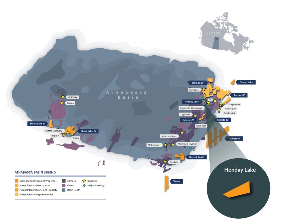
On Trend with Orano's Midwest Lake Deposit and West of UEC's Roughrider Deposit
About Henday Lake
The 100% owned Henday Lake property is 1,029 hectares in size and consists of 2 claims. This property is located nine kilometres northwest of Orano’s Midwest Lake deposit (41 million lbs. U3O8) and ten kilometres west of UEC’s Roughrider Deposit (57 million lbs. U3O8).
Hole HLH8-71 was drilled by Cogema Resources (now Orano Resources Canada Inc.) in 1998 and encountered a steeply dipping, strongly graphitic fault gouge at the bottom of the hole. The claims rest within a magnetic low believed to represent pelitic basement rocks, a typical host rock for economic uranium mineralization. The depth to basement is locally less than 350 metres.
Denison has released favourable exploration results from their Huskie Zone located approximately 10 km due east along strike from the Henday Block (Denison PR dated April 25, 2018). Results from WAT18-452 included 4.5% U3O8 over 6.0 metres (including 5.8% U3O8 over 4.5 metres), and 0.57% U3O8 over 6.3 metres (including 1.9% U3O8 over 1.0 metre).
The Henday Lake property falls within the Mudjatik-Wollaston Tectonic Zone, a northeast trending structural zone along the eastern margin of the Basin. The Mudjatik-Wollaston Tectonic Zone is the NE trending high strain tectonic zone marking the boundary between the Archean gneisses and granitoids of the Mudjatik Domain to the west and Archean gneisses, metasediments, and pegmatite intrusions of the Wollaston domain to the east.

